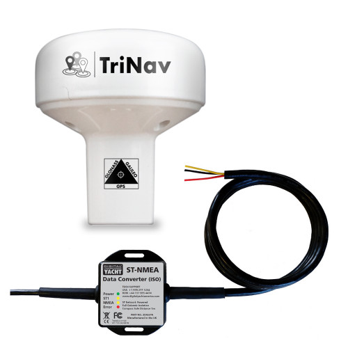
Product Description
Digital yacht DIGGPS160USB variant ships with a 5m USB cable
Model: ZDIGGPS160USB- 72 channel GPS, Glonass and Galileo GNSS positioning receiver
- Fitted with a 5M USB cable
- It’s self powered from the USB source (PC, MAC or Linux)
- Typically sub 1m accuracy thanks to TriNav™ technology —combines all satellite data for optimum accuracy
- Can be configured as dedicated GPS, Glonass or Galileo only device
- Sophisticated anti-spoofing algorithm for robust positioning performance and interference rejection
- User/field selectable 4800, 38400 and 115200 baud operation through simple internal DIP switches
- Multiple formats of NMEA data output including datum information —user configurable through internal DIP switches
- Up to 18Hz update rate (user selectable)
- Ultra low (<20mA) power consumption at 12V DC
- Professional system (ECDIS) support with datum sentence structure (DTM/GBS/GNS/GRS/GSA/GST)
- Puck installation or fits 3rd party industry standard 1" x 14TPI threaded mount
Digital Yacht have unveiled their TriNav™ GPS160, a new, high performance positioning sensor using GPS, Glonass and the new Galileo satellite systems for exceptional positioning accuracies and redundancies. Typical accuracy is better than 1m and data can be set to output at up to 18Hz for smoother plotter track displays. TriNav™ software technology also improves positioning vulnerabilities that could occur through spoofing and local interference.
The device can be field programmed for a variety of modes such as single GNSS operation (eg Galileo only) as well as output configurations such as update rate, NMEA sentence structure etc.
The GPS160USB variant ships with a 5m USB cable. It’s self powered from the USB source (PC, MAC or Linux). When installed, a virtual COM port is created on the host PC so navigation programs can receive positioning data. If a longer cable or the MOB feature is required, it’s best to utilise the GPS160 (standard NMEA version) with our USB-NMEA adaptor cable.
Galileo is the new global navigation satellite system (GNSS) that has been developed over the past two decades. It joins the GPS and GLONASS systems and offers mariners a 3rd reliable positioning source. It is planned to be fully operational in 2020.
There are currently 22 satellites in usable condition (satellite is operational and contributing to the service provision), 2 satellites are in "testing" and 2 more are marked as not available. The final constellation should be deployed by 2020 and will consist of 30 satellites (24 operational and 6 spares).


